If boating is part of your Siesta Key lifestyle, you have likely seen the yellow buoys and shoreline signs that slow everyone down. It is not just about courtesy. These zones protect manatees and shape how quickly you can reach the Gulf or cruise the back bays. If you understand where they usually appear and how to plan for them, you can set realistic travel times and choose a home that fits the way you want to boat. Let’s dive in.
What no‑wake and manatee zones mean
Florida protects West Indian manatees under state and federal law, and the waters around Siesta Key include designated areas to reduce collisions and disturbance. You will see different types of zones, each with specific operating rules.
- Idle/No‑Wake: Operate at the slowest speed possible while maintaining steerage and avoid creating a wake.
- Slow Speed: A low, posted limit intended to reduce risk. It often feels like a gentle plow rather than planing.
- No Entry/Closed Areas: Restricted or prohibited access.
Exact terms and markings vary by location. The rule of thumb is simple: follow posted signs and always verify current boundaries on official maps before you go.
Why Siesta Key has protected waters
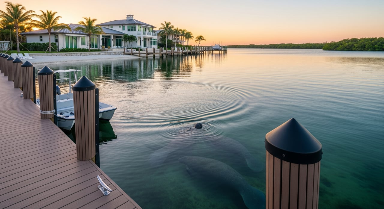
The Siesta Key area blends shallow seagrass beds, warm back‑bay waters, and narrow travel corridors where manatees feed, rest, and move between bays and the Gulf. Little Sarasota Bay, Roberts Bay, and the Intracoastal Waterway are prime examples. Without speed restrictions, vessel strikes are more likely in these environments.
For you, that means more idle or slow‑speed segments around basins, bridges, marinas, and channels that connect your dock to open water. Those rules safeguard wildlife and also help keep wakes down in tight waterways.
Where to check around Siesta Key
Typical local waterways to verify
Focus your map review on:
- Little Sarasota Bay between Siesta Key and the mainland.
- Roberts Bay and the northern corridors toward Sarasota Bay.
- The Intracoastal Waterway alongside Siesta Key, including bridge approaches and marina zones.
- Nearby passes that connect to the Gulf, such as the channels that feed Big Sarasota Pass and other local inlets.
- Shallow channels, canals, boat basins, and marina approaches along both the island and mainland shoreline.
How zones are marked
You will often see yellow regulatory buoys or posted shoreline signs that define speed restrictions. Some areas rely mainly on charted zones rather than conspicuous buoys. That is why reviewing current charts and official maps is essential.
Always verify on official sources
Zone boundaries can and do change. Use this quick workflow before any new route or home purchase decision:
- Start with the Florida Fish and Wildlife Conservation Commission’s manatee protection and speed zone maps for authoritative boundaries and seasonal updates.
- Cross‑check with the latest NOAA nautical chart or ENC for aids to navigation, depth, and regulatory markings.
- Review the most recent U.S. Coast Guard Local Notice to Mariners for temporary changes or buoy relocations.
- Confirm on‑the‑water details with Sarasota County Marine Patrol, the City of Sarasota, or a local marina/harbormaster.
How zones affect your cruising time
Idle and slow‑speed stretches reduce your average speed over ground, even if your boat can run fast in open water. A simple calculation can show the impact.
- Assume idle/no‑wake speed is 5 mph.
- Assume open‑water cruising is 20 mph.
If your route is 6 miles and 2 miles are no‑wake:
- With restrictions: (2/5) + (4/20) = 0.4 + 0.2 = 0.6 hours, or 36 minutes.
- Without restrictions: 6/20 = 0.3 hours, or 18 minutes.
That short idle segment doubles total travel time in this example. Around Siesta Key, frequent trips that pass through shallow back‑bays, bridge zones, or marina basins can add 20 to 100 percent to your time depending on route and conditions.
A planning method you can use
- Map your route and divide it into segments: idle/no‑wake distance and open‑water distance.
- Apply conservative speeds for each segment based on posted rules and your vessel.
- Add them up, then compare with your all‑open‑water estimate to see the extra minutes you should plan for.
What this means for everyday outings
- Short hops from canal docks to open Gulf water often include idle basins and slow bridge approaches.
- Back‑bay sightseeing cruises may be mostly slow speed with brief open runs.
- Longer ICW transits can blend several posted zones with stretches that allow higher cruising.
Route planning tips for local boaters
- Favor continuous stretches of deeper, open channels where higher speeds are permitted and safe.
- Identify pinch points like bridge approaches, marina clusters, and shallow flats where slow rules apply.
- Use your chartplotter or a mapping app to measure segment distances, then run the quick time calculation before you leave the dock.
- Consider alternative routes that stay in marked channels to limit time in idle basins when possible. Always confirm posted rules on the water.
Boat type and home choice
- Larger, faster boats gain more when routes include long open runs, but the same boats are slowed most by extended idle segments.
- Smaller craft may feel less difference between slow and open speeds, but you still must follow posted rules.
- If fast Gulf runs are your goal, weigh homes with direct access to open channels against those set deep inside idle basins.
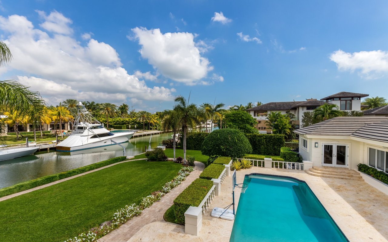
Dockage, marinas, and access
Where you keep your boat matters.
- Some private docks sit within idle basins or no‑wake canals that add several minutes at the start and end of every ride.
- Marina entrances and fuel docks are commonly slow zones. Plan a few extra minutes for approaches, docking, and waiting your turn.
- For frequent ICW or Gulf runs, evaluate a property’s proximity to marked channels and passes during both busy weekends and quieter weekdays.
Safety, enforcement, and penalties
You will see active enforcement by Florida Fish and Wildlife Conservation Commission officers along with local marine patrols. Penalties for violating manatee protections can include fines, citations, and more serious consequences if a manatee is harmed.
Practical safety habits help you stay compliant and protect wildlife:
- Keep a constant lookout. Manatees can surface with little warning and can be hard to spot.
- Slow down around seagrass beds, docks, and ramps even if a sign is not visible. These are common feeding and resting areas.
- Maintain required safety gear, including personal flotation devices, working navigation lights, and a communication device.
- Report distressed or injured manatees to the FWC wildlife hotline.
Quick checklist for buyers and owners
- Verify manatee and speed zones on FWC’s official maps before you plan routes or buy.
- Cross‑check NOAA charts and scan the latest U.S. Coast Guard Local Notice to Mariners.
- Ask local marinas or marine patrol about commonly enforced hot spots and seasonal patterns.
- Time a few sample runs at different times of year to understand real‑world cruising times.
- Evaluate dock location and canal conditions. Idle basins and tight canals can add minutes to every outing.
- Match boat type to your preferred routes. If you prize quick Gulf access, prioritize properties with fewer slow segments between dock and pass.
Make your Siesta Key move with confidence
With the right local guidance, you can enjoy the island lifestyle while respecting protected waters and planning efficient routes. If you are evaluating a Siesta Key home for its boating access, we can help you interpret maps, assess dockage, and estimate realistic cruising times from the property you are considering. For discreet, expert waterfront advice, connect with Cassandra Miller.
FAQs
How do I verify current no‑wake and manatee zones near Siesta Key?
- Use the Florida Fish and Wildlife Conservation Commission’s official manatee speed zone resources, confirm with NOAA charts, and review the U.S. Coast Guard Local Notice to Mariners.
Do on‑water buoys always mark every manatee zone around Siesta Key?
- Not always. Many zones are posted, but some are charted and enforced without conspicuous buoys, so always check official maps before you go.
Will manatee rules block my access from Siesta Key to the Gulf of Mexico?
- Gulf access is not typically closed, but speed restrictions in passes and shallow channels can slow your transit; check for any temporary notices before outings.
How much extra time should I budget for local trips by boat?
- It depends on your route. As an example, a 6‑mile trip with 2 miles of no‑wake can double total time from about 18 to 36 minutes; run your own segment calculation.
Who enforces manatee and no‑wake zones in the Siesta Key area?
- Florida Fish and Wildlife Conservation Commission officers and local marine patrols handle enforcement, with penalties for violations that can include fines and other consequences.